As just about any decent map can tell you, 74 runs from a lonely little interchange on I-84 up by the Columbia down through small farm towns and back up to another lonely little interchange just east of Vinson on US Route 395. None of it surprising and none of it very interesting on the surface. And while you can see the big sweeping curves around the bluffs on 74 to the northwest of Heppner and the sharper squiggles to the northeast, the map doesn’t really tell you what you need to know about the highway.
Namely that this road should really be broken down into two parts because they’re quite different roadways.
The northwest leg of Route 74 is best described with: sweeper. Long ones and short ones, all running around 50mph or more. Now don’t get me wrong about them. They’re not bad, but they’re not exhilarating either, since Central Oregon can easily spoil you for fantastic roads. The valley this road runs down is mostly wheat fields and every single square foot of tillable land is planted, which means the road is shoved up against the side of the valley. There’s a few spots with a handful of really nice corners, but they’re not enough to keep a sport rider happy.
And the towns do slow you down, and then back up to speed once you’re though. But unlike your typical wetside drivers that seem to endlessly potter along at 7-under, you won’t see much of that here. There’s so little around that people are obviously going somewhere if you see them out on the road. And they’re usually hauling ass.
I was always flying through the sweepers on this road the couple times I’ve ridden it. The local were moving and obviously far more willing to flirt with the risk of getting a ticket than I.
Concerning that northeast leg of Route 74, well now. It’s a little more interesting. The road is just about completely empty on the Sunday afternoon that I rolled through. I think a saw 3 cars between Vinson and Heppner and was a little wierded by the sudden appearance of dozens of cars once I get into town.
Not to mention that when I got into town, I was suddenly assaulted by a need to instantaneously pull out my dirt riding skills. Inexplicably, the government of city, county, or state, or whatever had decided to rip the entire road out. I rode through a full quarter-mile of deep gravel that far exceeded what any rational road engineer could possibly decide is needed for chip-sealing.
And much like Route 206 out the southwest end of town, 74 has no services between US 395 and Heppner. There’s the usual services in Heppner, but nothing in Vinson except for an old service station that hasn’t sold gas since about World War II.
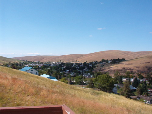
City of Heppner
One inescapable facet of Route 74 is the wind. I simply could not believe how hard the wind was blowing that Sunday afternoon. It wasn’t like it was all that hot as some rain showers had blown through a few hours previously. It was a consistent 30mph wind with gusts above 45. If it wasn’t for the insane amount of traction on that sharp-edged chip-seal, I probably would have gotten blown off the road and into the weeds.
And regarding getting blown off the road on 74? Well, don’t. This road has much more in the way of twisties than the NW section since it seems to frequently ascend and descend the sides of the ridge that rises to the southeast of Heppner. Serious pucker moments were had when I came around hairpin turns from the lee side of the hill into the teeth of a 45mph gust while trying to power the bike through a 25mph hairpin.
Yes, I still highly recommend this section of the road, but I also highly recommend scheduling it for the morning when it won’t kick your keister quite so hard.
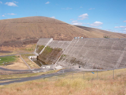
Willow Reservoir Dam
- Counties: Umatilla, Morrow, Gilliam
- Length: 83 miles
- Towns: Heppner, Lexington, Heppner Junction, Cecil, Ione, Vinson
Google Map for Oregon State Route 74: