Up on the high plains of north-central Oregon, it seems sometimes that all roads lead to Mt. Hood. No matter where you turn your front wheel, if you’re not heading due east, that road will eventually take you towards Hood.
No surprise there, frankly. Even from 75 miles away, if you have an unobstructed view to the west, it’s quite easy to see where Hood is even when wrapped in cloud and snow.
All sorts of roads lead there, from challenging two-track trails that wind hither and yon to arrow-straight forest service roads and the gently-sweeperish US26 federal highway. All leading onwards and upwards towards Hood.
In the case of Dufur Valley Road, east of the National Forest border, you get a sleepy two-lane farm-to-market that fully justifies the name it carries through its middle section: Dufur Market Road. It’s mostly short straight section with an occasional 30-45 degree curve marked at 45 that could be taken at 75 where it not for the 50mph speed limit.
The interesting part of this particular road is clear out on thwe west end where it meets up with Oregon Route 35. Dufur Valley Road and FS44 both slowly climb up out of the Deschutes River watershed over the course of several dozen miles and you never really grasp how much altitude you’ve gained unless you’re running an altimeter-equipped GPS.
Dufur is listed as a mere 1350 feet, but if memory services, FS44 tops out at well over 4000 feet. That means you have a mere 5-6 miles to shed 2500 feet at the west end. And yes, it’s very twisty.
Once you get to crest, it’s more or less unremitting twisty curves all the way to the bottom, and it’s a bit nerve-wracking if you aren’t certain that the temperature is above freezing. During my trip, I rolled through there around 9am, and it had been 50F at Dufur but was flirting with freezing up at the top. You really don’t want to have to be thinking about blind corners with ice in the roadway, especially when it’s August and you haven’t had to think about ice during one’s daily moto-commutes in about 3-4 months.
Dufur itself is one of the larger towns in Wasco County. It’s got a large K-12 school there for the surrounding farmsteads and a restaurant and hotel. Oddly, one thing I don’t remember seeing in Dufur is a gas station.
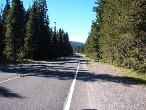
A typical sweeper on FS44:

- Counties: Wasco, Hood
- Length: 27 miles
- Towns: Dufur