Please note: Some mapping systems incorrectly indicate this road as South Bank Road for all or parts of its length.
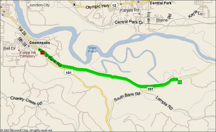
This lovely little gem is a two-lane squiggle that doesn’t show up on most paper maps. To truly understand, it must be first put into perspective. To go to Aberdeen from the east, you take US12 on the north side of the river. To skip Aberdeen and take US101 south, you take SR107. Blue Slough splits off halfway down 107 and hugs the riverine landscape as 107 heads south. This leaves BSR as a lonely little orphan heading into Cosmopolis, shoehorned between the slough and shore, weaving a crooked little path with no homes to call its own.
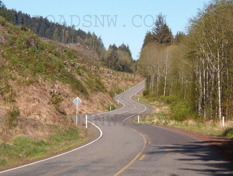
Which, of course, is a pure slice of heaven for us. As illustrated in that luscious photo of the esses along BSR, this road is a veritable roller-coaster ride. Most of the curves are rising and falling in addition to their curvature. If you’re tired of the freeway droning, this will perk you right up and make you want a cigarette when you’re through.
On the fine April Saturday that I ventured onto BSR< this little road more than exceeded the 30 seconds, coming across but on car on its whole length, and that care even waved to me! For a jaded Seattle moto-commuter, that shock to the system was rather profound.
BSR consists of well-seasoned chipseal. The roadbed appears to be quite well-constucted as there were no tire-track dips even along the edges of the marsh, where the area log trucks would do the most damage. BSR, like SR107 to the south, appears to be subject to washouts and mudslides. Both roads had sections where the path of the road suddenly jogs away from the hillside and is filled with packed gravel and a coating of loose stones.
If you’re heading down the coast and getting there via US12 and SR107, try out this little piece of pavement and don’t believe when your map when it says it’s arrow straight. I give it two thumbs up.
- Counties: Grays Harbor
- Length: 5
- Towns: Cosmopolis
Overview Map:
Google Map:
View Larger Map