Old Washington SR209 is a small, narrow, winding country road that provides easy access to Lake Wenatchee without the traffic inherent in traveling through downtown Leavenworth while tourists are in season. The road in indeed quite narrow and very twistly, winding between the various farms, railroad trestles, and geologic formations and artifacts.
“The road surface itself is typically rough and patchy. the corners are generally 30-35 with a couple very nice hairpins in the center area of the road. most of the corners themselves are very nicely radius’ed and cambered properly. Indeed, the corners very frequent but with the obvious and inherent limits that places on sight lines in a forested area.
You can get to the north end of 209 from US2 by heading north from Coles Corner and taking SR207. There’s a very good gas station there at Coles Corner from which you can head directly north for a few miles before the more than adequately-signed right hand turn onto 209.
If you prefer to do 209 from the south, head north from the large grocery store on the east end of Leavenworth. I don’t recall at this time, but it might be signed as Plain Rd. or Chumstick Rd. at that point. Please let me know if you know which it is.
A little historical note of interest to road and highway buffs, 209 is actually no longer a Washington State Highway. it was decommissioned by the State Legislature in late 1992. If my memory serves, the very large sign denoting the right hand turn off 207 still has the SR209 sign posted on it.
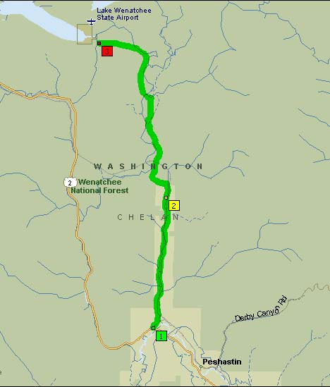
Old SR209 is located north of Leavenworth and heads up to Lake Wenatchee.
Map of Old State Route 209:
Google Map: