Way up in the heart of the Oregon Cascades is a real gem of a road. If you’re heading down into Central Oregon, this road is a must-ride.
Aufderheide Scenic Byway runs between Oregon Highway 126 and Westfir off Highway 58. The south end of the road isn’t terribly easy to find, but if you can locate the white covered-bridge in Westfir you’re in the right spot.
If you’re riding Aufderheide from the north, you have some of the best reservoir sweepers I’ve ever seen. The pavement is very smooth with few kibbles on this late July weekend. Nearly all of the curves are perfectly-constructed with even radius and neutral camber. The scenery is flat fantastic too, but you’re mostly too busy looking up into the next corner, leaned way over and feeding the throttle.
One of the interesting highlights of Aufderheide is around MP27, a massive stand of 200+ year old trees called Constitution Grove. Many of the trees are named after U.S. Presidents and the spot provides for a nice, safe resting spot at the halfway point of the road.
There are a few pitfalls to concern yourself with on this road.
On the south end there is an intersection that can be quite challenging if approached from the south. The curve itself is a 15-25mph decreasing radius curve, but a non-desired side-road goes straight ahead and tend to cause the rider to fixate on the gravel for a moment and disrupting the flow of the curve.
Another is a hairpin that is situated amongst a couple easy sweepers after very long straights on both sides. This one is really reach out and grab if you’re not watching. This is located around the mid-point of the roadway around MP30 in the Box Canyon Road section. If you have a GPS with a decent level of detail, you will probably be able to see this very noticeable curve when you come up on it.
- Road Name: Forest Road 19 (‘Robert Aufderheide Scenic Byway’)
- Counties: Lane
- Length: 58 miles
- Towns: Westfir, Willamette City
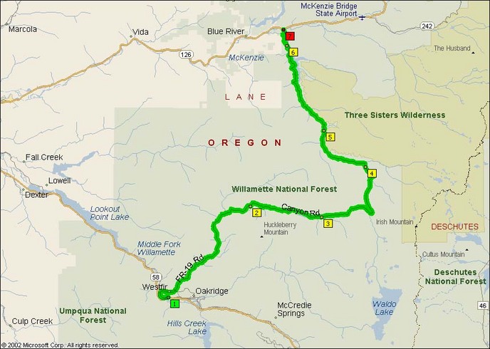
Overview Map:
Google Map: